

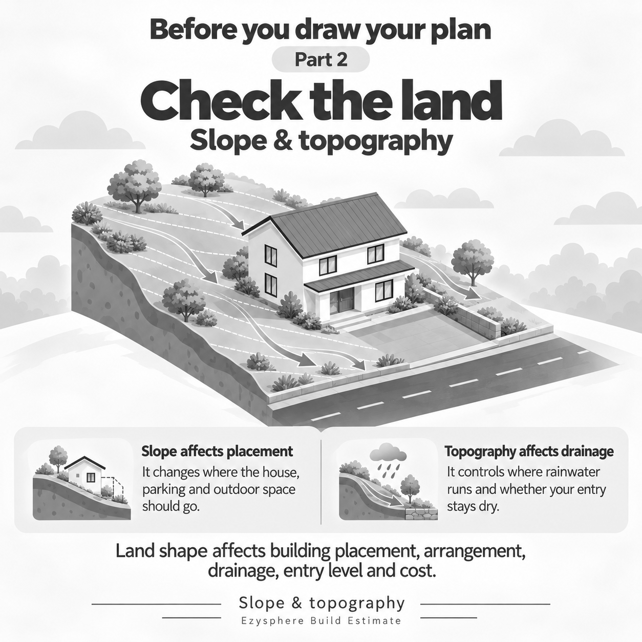
One interesting thing is that a perfectly flat plot is not necessarily better than a sloping plot. A gently sloping plot can offer easier natural drainage, while a flat plot surrounded by higher land may experience serious flooding.
1. First, understand the difference
Topography describes the overall physical shape and elevation of the land, including hills, valleys, depressions, ridges and changes in ground level.
Slope describes how steeply the ground rises or falls over a horizontal distance.
For example, land that rises by 1 metre over a horizontal distance of 20 metres has a 5% slope.
That seemingly small difference can noticeably affect how a house is constructed.
2. Different types of plots and their implications

A. Relatively flat land
Usually easier for conventional layouts, foundations, parking and accessibility.
Watch out: Water can accumulate when there is inadequate drainage or the plot is lower than surrounding properties.

B. Gently sloping land
Can make natural rainwater drainage easier and offer opportunities for interesting building layouts.
Watch out: Foundation levels and landscaping must accommodate the change in elevation.
C. Steeply sloping land
May allow split-level architecture and elevated views.
Watch out: More complex foundations, excavation, slope stability assessment, retaining walls and construction access can increase costs substantially.

D. Depressed or low-lying land
May appear flat and easy to develop.
Watch out: Water from neighbouring plots may flow toward it, creating flooding, dampness and drainage problems.
The critical lesson is that the shape of the land must be considered together with surrounding ground elevations, soil conditions and available drainage outlets.
3. The direction of the slope matters
Imagine you have two plots of the same size, both with an elevation difference of one metre.
Plot A: Slopes toward road
Rainwater naturally tends to move toward the frontage. A suitable drainage outfall is still necessary.
Plot B: Slopes away from road
Water may flow toward the rear boundary, making an appropriate drainage outlet potentially more difficult.
Neither plot is automatically better.
For Plot A, the challenge might be creating a suitable driveway while ensuring rainwater does not flow into the building.
For Plot B, the challenge might be preventing water from accumulating at the rear or discharging into neighbouring properties.
The direction water can legally and safely leave the property is often more important than the slope direction alone.
4. How slope affects the actual house design
Design element | How topography influences it |
|---|---|
Foundation | May require stepped footings, different founding levels or another engineered solution |
Floor level | Must account for surrounding ground elevations and flood risk |
Entrance | May require stairs, ramps or changes to the driveway gradient |
Drainage | Influences surface runoff routes and collection points |
Building footprint | A layout following the contours may reduce excavation |
Landscaping | May require terraces, stabilised slopes or retaining structures |
Construction cost | More excavation, structural work, drainage or fill may be necessary |
The cut-and-fill problem
One common approach is to excavate the higher side of a sloping plot and use fill to raise the lower side.
This may create a level platform, but it introduces important engineering considerations.
The fill needs to be suitable, placed and compacted properly. Structural foundations should not simply be placed on uncontrolled fill.
Also, excessive cutting near adjoining land can destabilise soil or existing structures. Retaining walls, where needed, require appropriate design and drainage.
Sometimes, working with the natural slope through a stepped building arrangement is more economical than forcing the entire plot to become level.
5. What information should be collected before drawing the plan?
Ideally, obtain a topographic survey prepared by a competent surveyor. Unlike an ordinary boundary survey alone, a topographic survey should record elevations and relevant existing features.
Key information includes:
Ground levels at important points, especially plot corners, road frontage and neighbouring boundaries.
Contour lines or other sufficient elevation measurements to understand the site's shape.
Highest and lowest ground elevations and the main direction of surface runoff.
Existing drainage channels, gutters, culverts and possible outfalls.
Road level relative to the land and intended building entrance.
Evidence of erosion, ponding, previous filling or retaining walls.
Existing neighbouring building and ground levels where relevant.
The survey information should then be reviewed alongside the geotechnical investigation.
6. Three mistakes I would particularly avoid in Nigeria
Mistake 1: Raising the compound without planning drainage. Filling a site can redirect rainwater toward neighbours, create trapped water between buildings and boundary walls, or cause flooding elsewhere.
Mistake 2: Treating the road as the drainage outlet automatically. A roadside drain may be absent, too shallow, blocked, undersized or unsuitable for connection.
Mistake 3: Assuming higher ground has no water problem. Elevated plots can still experience severe erosion, rapid surface runoff or slope instability.
7. The questions that determine the best response
For a residential building, I would want to establish three things before choosing the building's position:
Where will water go? The natural drainage routes and safe discharge destination.
How much does the ground level change? The elevation difference across the proposed building footprint and access routes.
Should the building follow the land or should the land be reshaped? A design and cost decision informed by soil and stability considerations.
An interesting next question
Suppose you are given a 15 m × 30 m plot that slopes downward by 1.5 metres from the road toward the back.
Would it be better to:
Raise the back with fill to make the entire compound level?
Use stepped foundations and retain the natural slope?
Position the house near the front and manage the lower rear as landscaping and drainage space?
This is where topography becomes a real architectural and civil engineering design problem. The answer depends on the soil, drainage outlet, flood risk, available space and cost, rather than slope alone.